
 Ecuador is one of the smallest countries in South America, but one of the most biodiverse in the entire world.
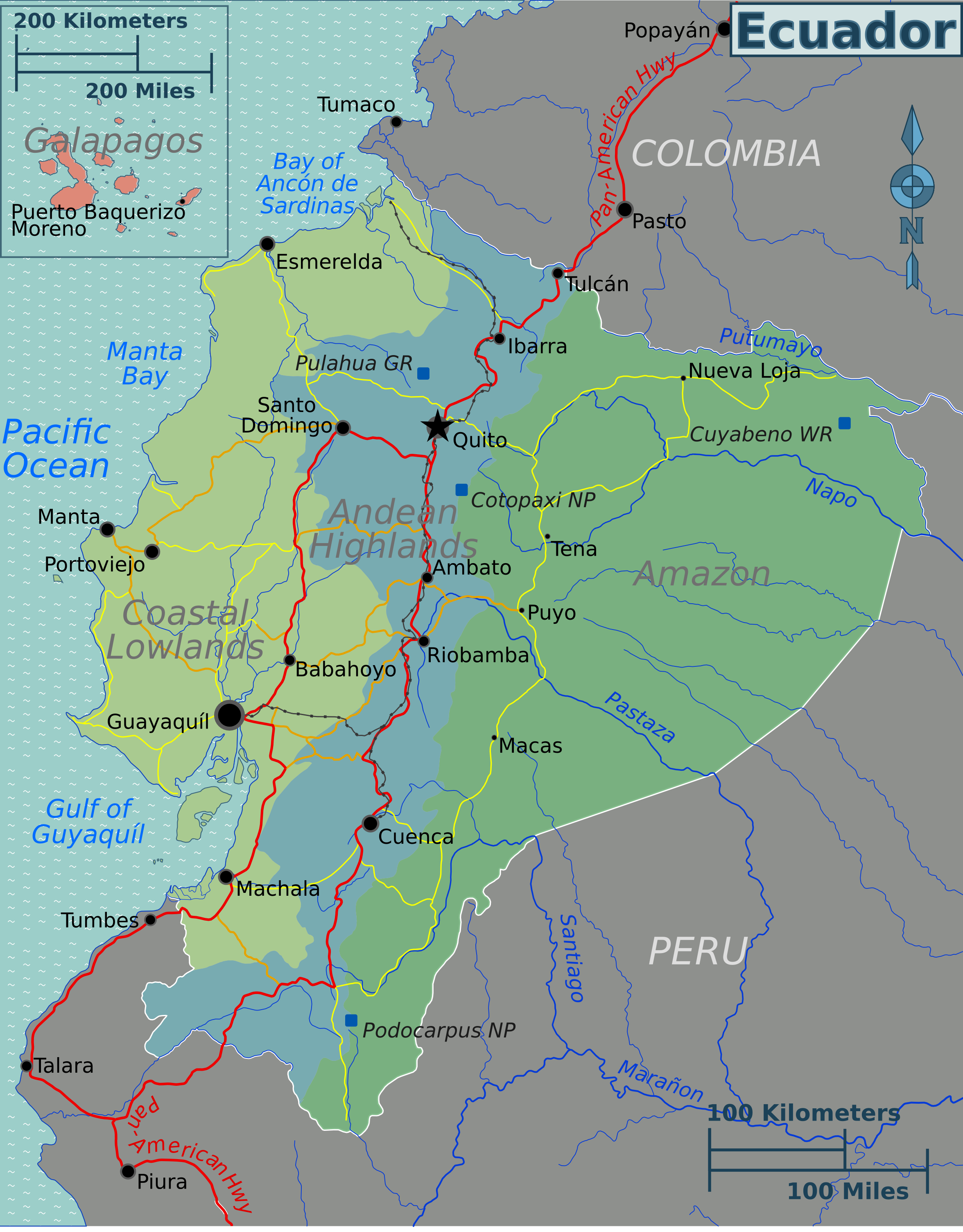
It belongs to the 17 mega-diverse countries and hosts 4 main geographical zones:
 The Coast (la costa) – which is most known for the production of bananas and generally the most productive and fertile part of the country. Big rice fields, tremendous African palm oil plantation and of course fishing are located in this area.
- The Highlands (la sierra) – which basically includes the Andeans and the Interdream territories. Here you can find Glaciers and most of Ecuador’s volcanoes. This region’s main income is agriculture.
- The Amazon (la Amazonia) – is dominated by the national parks and the largest reserve of petroleum. In recent years, the area became more famous for the production of palm oil.
- Galapagos Islands – located approximately 1,000 km west of the mainland is Ecuador’s biggest National Park and natural reserve.
In general, traveling through Ecuador is mind-blowing and indescribable, as every part, every corner is different. It offers rainforests, the Amazon, cloud forests, mountains, glaciers, volcanos, the Andeans, deserts, … and any type of weather and temperature throughout the year – depending on the region. Ecuador is considered safe for travelers and is worth a visit in every season.
